MODIS Land
![]()
- determines the MODIS tile grid position, as well as the line and pixel within the tile, for any lat/lon point
- determines the lat/lon for a MODIS line, pixel within a tile
- specifies desired projection at the top of the page
The MODIS land products are produced at 4 resolutions (250m, 500m, 1km, and 0.05 degree), and in 3 projections (Sinusoidal, Lambert Azimuthal Equal-Area, and Geographic). The simple Geographic lat/lon projection is only used for the coarsest resolution grid, produced at 0.05 km (~ 5.5 km), which is referred to as the Climate Modeling Grid (CMG). In order to maintain reasonable file sizes for the other higher resolution MODIS land data products, each projection is divided up into a tiled grid. The land products are thus produced and distributed in adjacent non-overlapping tiles that are approximately 10 degrees square (at the equator). Most of the higher resolution MODIS land products are produced in the Sinusoidal tile grid, except for the Sea Ice products, which are produced in the polar Lambert Azimuthal Equal-Area tile grids.
Details of the MODIS grids can be found below.
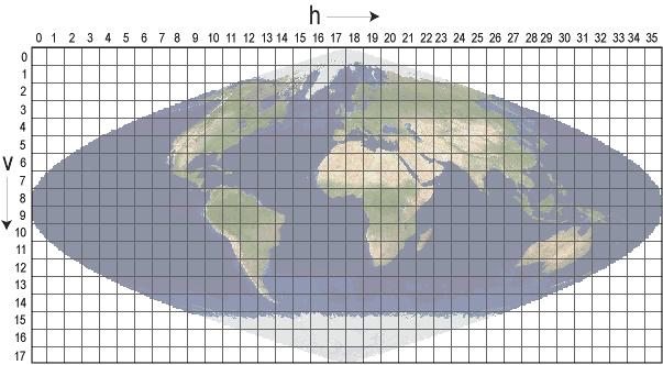
Sinusoidal Tile Grid
There are 460 non-fill tiles, tiles are 10 degrees by 10 degrees at the equator.
The tile coordinate system starts at (0,0) (horizontal tile number, vertical tile number) in the upper left corner
and proceeds right (horizontal) and downward (vertical). The tile in the bottom right corner is (35,17).
- Table of Tile Bounding Coordinates (10 deg tiles).
- Table of Tile G-ring Coordinates (10 deg tiles).
- General Cartographic Transformation Package (GCTP) projection parameters and other tile infomation.
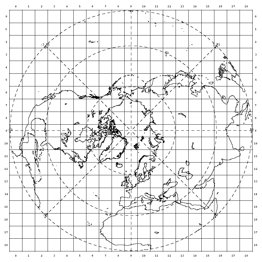
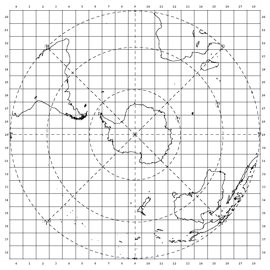
Lambert Azimuthal Equal-Area Tile Grids (Polar)
- There are 626 non-fill 10 deg. by 10 deg. tiles in the grid. Half of the tiles (313) are in the north polar grid and the other half in the south polar grid.
- The north polar grid tile coordinate system starts at (0, 0) (horizontal tile number, vertical tile number) in the upper left corner and proceeds rightward (horizontal) and downward (vertical). The tile in the bottom right corner is (18, 18). Click on image for larger version.
- The south polar grid tile coordinate system starts where the northern grid ends, at (0, 20) and the tile in the bottom right corner is (18, 38). Click on the image for larger version.
- The polar grids are based on the Lambert Azimuthal Equal Area map projection centered on each pole. The grids are compatible with the NSIDC EASI grid.
- Table of Tile Bounding Coordinates
Geographical Projections
Climate Modeling Grid (CMG)
The Climate Modeling Grid datasets provide global coverage in a Geographic Lat/Lon projection at a resolution of 0.05 degrees. The geographic coordinates of the upper-left corner of the upper-left pixel of a MODIS CMG image are -180.00 degrees longitude, 90.00 degrees latitude. The geographic coordinates of the lower-right corner of the lower right pixel are 180.00 degrees longitude, -90.00 degrees latitude.
Linear Latitude/Longitude Grid
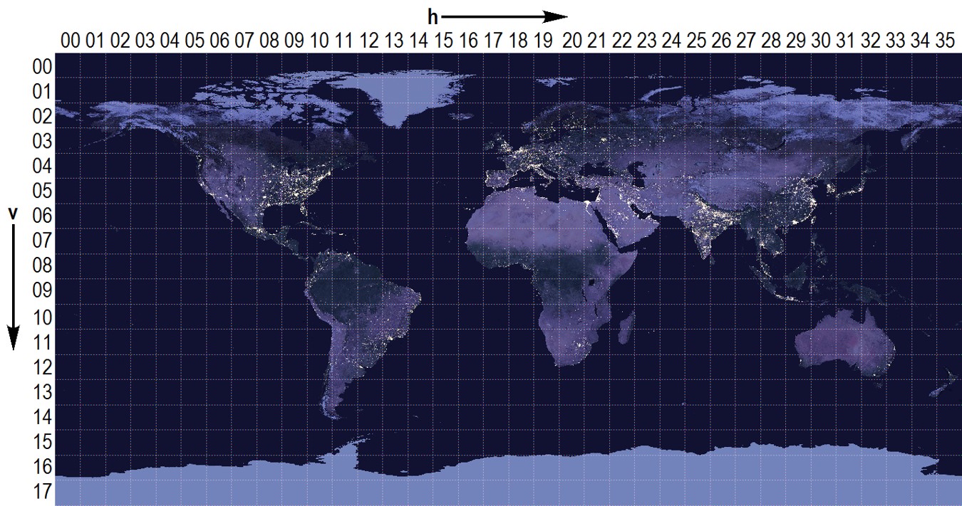
The MODIS Flood Map (MCDWD) product uses the geographical linear latitude/longitude projection. This geographical projection consists of 460 non-overlapping land tiles that measure approximately 10°X10°. The tile coordinate system starts at (00,00) (horizontal tile number, vertical tile number) in the upper left corner and proceeds right (horizontal) and downward (vertical). A table of lat/long bounding (G-ring) coordinates can be found here. This projection is also used by the VIIRS DNB (VNP46) gridded product. The image below shows the lat/long grid over the SNPP VIIRS Day/Night Band product.