- Integerized Sinusoidal
- Hammer Atioff
- Goode's Homolosine
Collection 3 and earlier data products were produced in the Integerized Sinusoidal Grid, which is no longer used.
Each grid is broken into a number of non-overlapping tiles that cover an area approximately 10 x10 degrees. The tiles are identified by a vertical and horizontal positional Tile ID.
The Hammer Aitoff and Goode's projections were planned, but never implemented.
|
|
Grid Details
Click on images to see larger version |
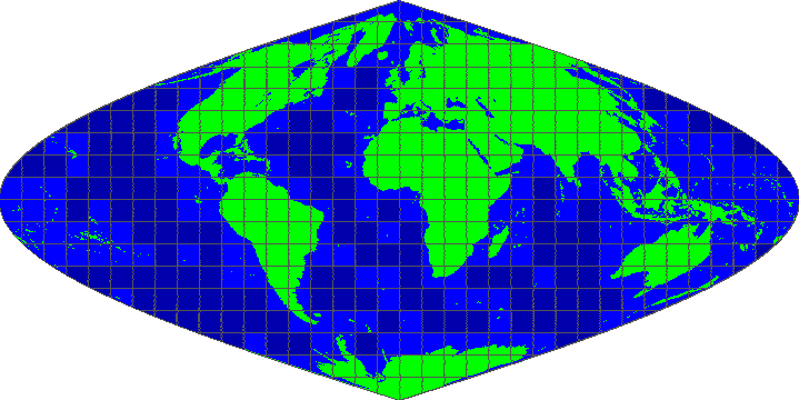
MODLAND Integerized Sinusoidal Grid
(no longer used)
10 degree tiles
- There are 460 non-fill 10 deg. by 10 deg. tiles in the grid.
- The tile coordinate system starts at (0,0) (horizontal tile number, vertical tile number) in the upper left corner and proceeds to the right (horizontal) and downward (vertical). The tile in the bottom right corner is (35, 17).
- Dark blue tiles contain only water (no land).
- The boundaries of tiles outside of the grid's image area are not shown.
- Projection parameters for the General Cartographic Transformation Package (GCTP).
- References for the Integerized Sinusoidal Projection.

|
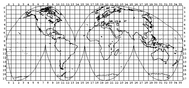
Goode's Homolosine
- There are 543 non-fill 10 deg. by 10 deg. tiles in the grid.
- The tile coordinate system starts at (0, 0) (horizontal tile number, vertical tile number) in the upper right corner and proceeds rightward (horizontal) and downward (vertical). The tile in the bottom right corner is (17, 35).

|
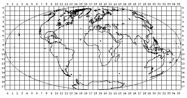
Hammer Atioff
- There are 552 non-fill 10 deg. by 10 deg. tiles in the grid.
- The tile coordinate system starts at (0, 0) (horizontal tile number, vertical tile number) in the upper left corner and proceeds rightward (horizontal) and downward (vertical). The tile in the bottom right corner is (17, 35).

|
|
| |


