
Volcano Hot Spots
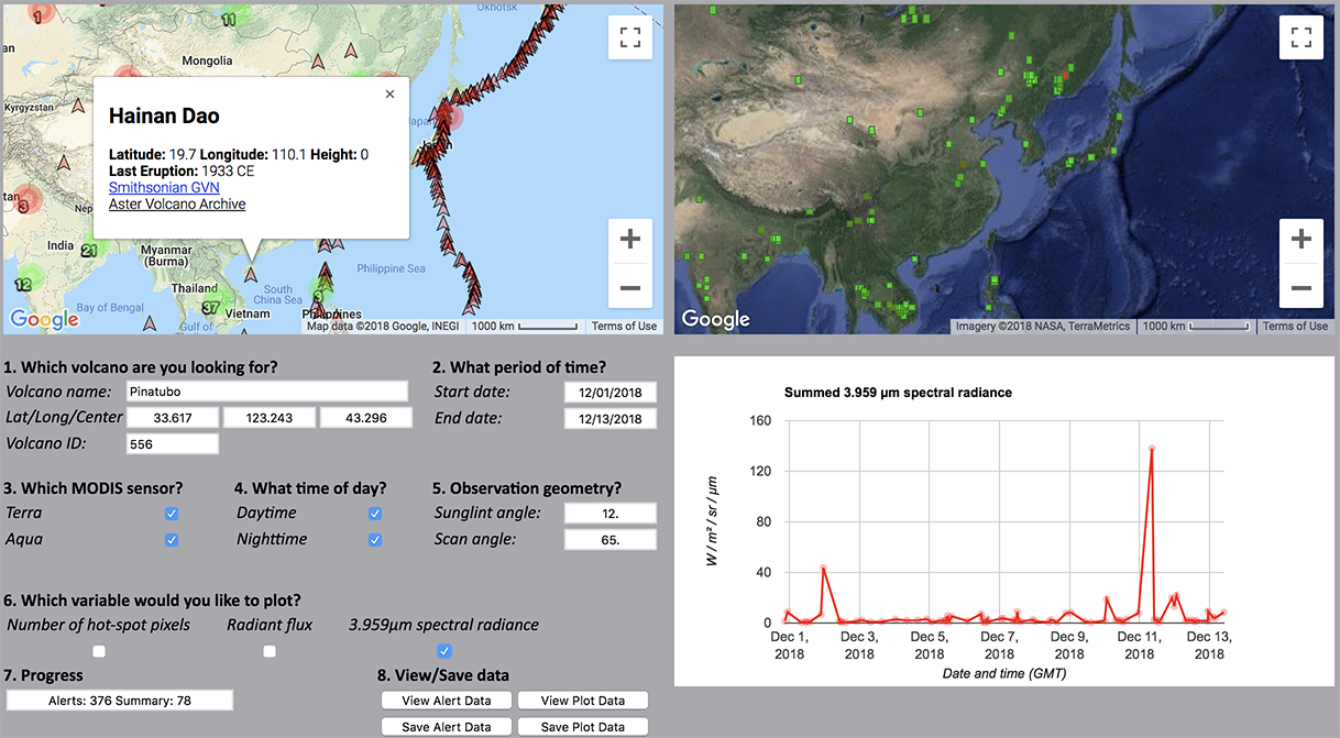
MODVOLC uses the infrared satellite data acquired by NASA's MODIS instruments to monitor the Earth's surface for the thermal emission signature of volcanic eruptions, wildfires, and anthropogenic heat sources (e.g. gas flares). Both MODIS sensors, one on the Terra satellite, and the other aboard the Aqua platform, allow the entire Earth to be monitored every 48 hours.
If an eruption is detected, the details of the event are reported here, usually within 12-18 hours of the satellite passing over the volcano. You can search, plot, and download the data using the tools, as shown in the sample to the right. The processing and the online tool are available at the MODVOLC website, located at the University of Hawai'i, at Mānoa. Further information describing the algorithm and the data can be found in the publications below.
Product PI: Robert Wright
PI-maintained product web page
User Guide
ATBD
References
Wright, R, Flynn, L., Garbeil, H., Harris, A., Pilger, E., 2002, Automated volcanic eruption detection using MODIS, Remote Sensing of Environment 82 (2002) 135-155. http://modis.higp.hawaii.edu/doc/wright2002.pdf
Wright, R, Flynn, L., Garbeil, H., Harris, A., Pilger, E., 2004, MODVOLC: near-real-time thermal monitoring of global volcanism, Remote Sensing of Environment 82 (2002) 135-155. http://modis.higp.hawaii.edu/doc/wright2004.pdf
Wright, R, Flynn, L., Garbeil, H., Harris, A., Pilger, E., 2006, MODVOLC: 14 years of autonomous observations of effusive volcanism from space, Geological Society, London, Special Publications, 426, 23-53, 27 August 2015, https://doi.org/10.1144/SP426.12
